
Our Initiatives
AASG works with the U.S. Geological Survey and other federal partners on national geoscience programs that rely on the expertise of State Geological Surveys. These partnerships support geologic mapping, critical mineral assessments, and the preservation and availability of geoscience data across the country.
STATEMAP
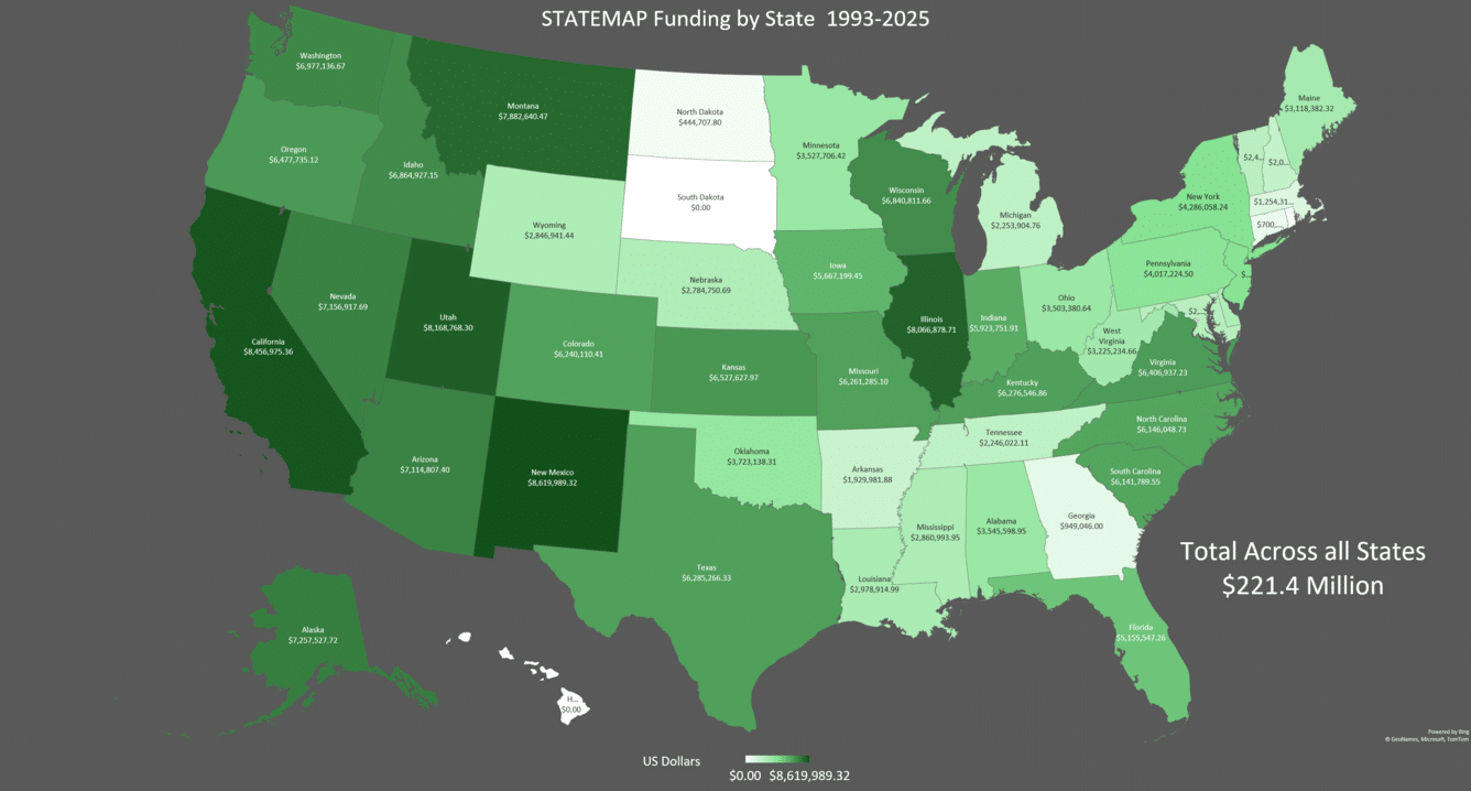
STATEMAP is the state component of the U.S. Geological Survey's National Cooperative Geologic Mapping Program. The program provides matching federal funds to State Geological Surveys to conduct geologic mapping based on state and national priorities.
The resulting maps and data are used for water resources, geologic hazards, infrastructure, land use, energy, mineral resources, and many other applications. AASG works closely with the USGS on priorities for the program and represents the interests of State Geological Surveys in the national mapping effort.
Earth MRI
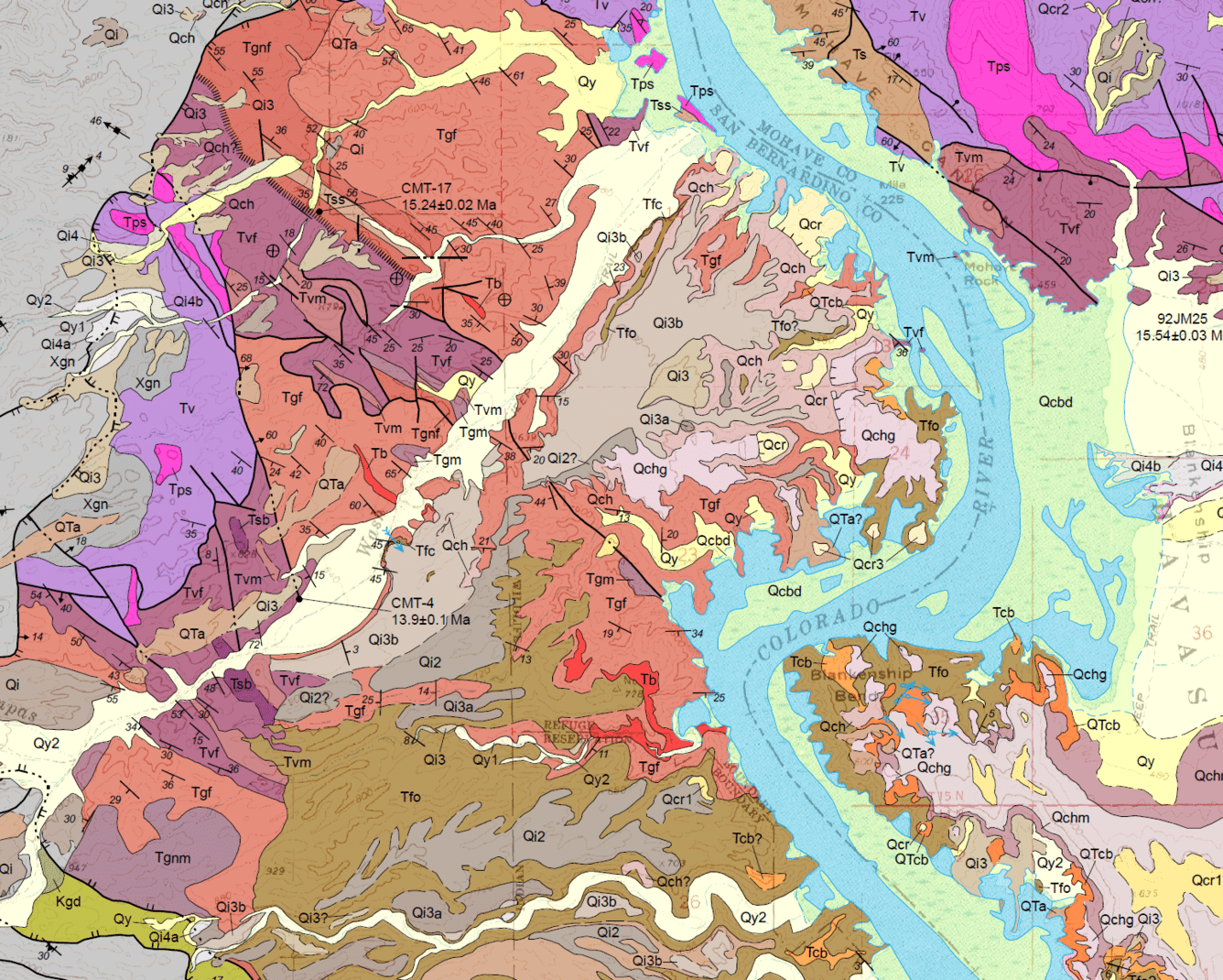
The Earth Mapping Resources Initiative, or Earth MRI, is a partnership led by the U.S. Geological Survey to improve our understanding of the nation's critical mineral resources.
State Geological Surveys are major partners in this effort. Projects include geologic mapping, airborne geophysical surveys, geochemical sampling, lidar, and analysis of existing geoscience data. The goal is to improve the basic geologic information needed to identify areas that may contain critical mineral resources.
NGGDPP
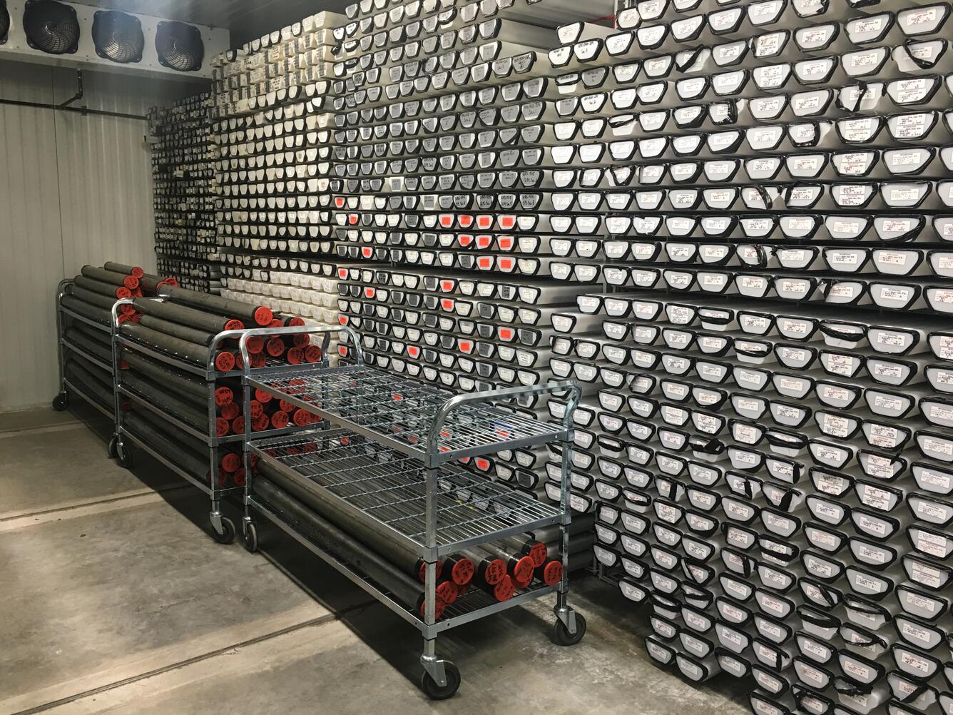
The National Geological and Geophysical Data Preservation Program, or NGGDPP, is a partnership between the U.S. Geological Survey and State Geological Surveys to preserve and provide access to important geologic information and collections.
These resources include rock and sediment cores, samples, maps, photographs, records, and digital data collected over many decades. Preserving these materials protects previous public investments and makes information available for new research and future geoscience needs.